We’re excited to announce a major new addition to Postcodeheatmap: Custom Territory Maps — built especially for organisations with multiple teams working across different geographic regions.
If you manage sales teams, regional operations, or account territories, this new feature will help you define, visualise, and report on your custom territories with ease — all in one place.
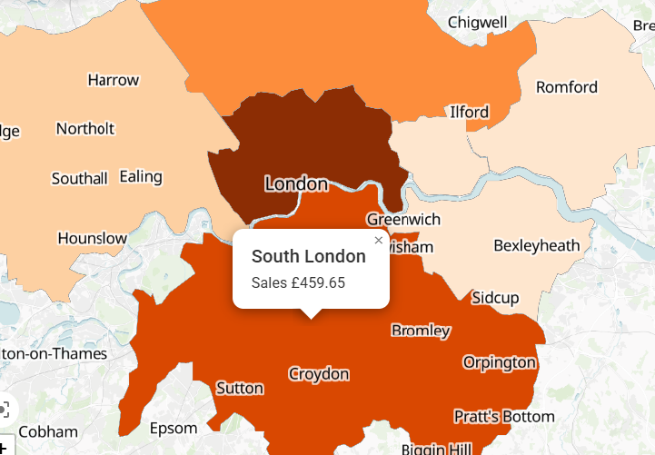
🎯 What Are Custom Territory Maps?
Custom Territory Maps let you group postcode regions into defined territories that align with how your teams work in the real world. Then, you can overlay spreadsheet data onto these territories to generate heatmap visualisations.
Perfect for:
- Sales teams with assigned regional areas
- Franchise or partner territories
- Regional performance comparisons
- Internal reporting and strategic planning
🔧 How to Create a Territory Map
Getting started is easy:
- Log in to your Postcodeheatmap account
- In the map editor, find the toggle for “Use Custom Territory Map” in the map selection panel
- Choose to:
- Select an existing territory map, or
- Create a new one using our step-by-step Territory Map Creation Wizard
- Once set, you can apply spreadsheet data just like any other map
You can combine your data with custom territories, generate reports, or export the map as an image — perfect for presentations or internal dashboards.
📤 Share & Report
Once your territory map is created:
- Publish it to share with your team or stakeholders
- Export it as an image for reports or slide decks
- Use it to generate region-specific analytics based on your own territory structure
To try these features and create beautiful postcode heatmaps then head over to https://postcodeheatmap.com/.