We’re excited to share the latest updates to Postcodeheatmap, including one of our most requested features: Map Markers!
📍 Introducing Map Markers
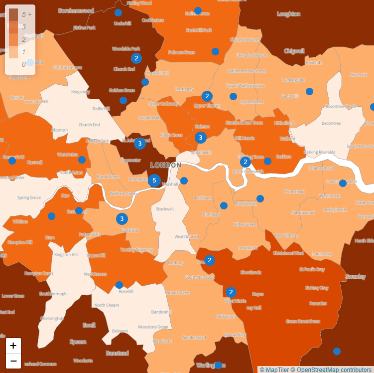
You asked, we listened! You can now add marker layers to your heatmaps, making it easier than ever to visualize data points like store locations, delivery drop-offs, or customer addresses alongside your postcode heatmaps.
How It Works
Within the Postcodeheatmap toolbox, you’ll now find two layer options:
- Heatmap Layer: For density-based visualizations.
- Markers Layer: For individual data points.
Marker clustering helps keep your map clear and usable by grouping nearby markers together, adjusting as you zoom in or out. This means you can handle large datasets without overwhelming your map.
You can also use different datasets for your heatmap and marker layers. For example:
- Show a heatmap of customer density.
- Overlay markers to show store or sales rep locations.
🗺️ Other Improvements
- More detailed place labels have been added to enhance map readability and provide more context at a glance.
To try these features and create beautiful postcode heatmaps then head over to https://postcodeheatmap.com/.